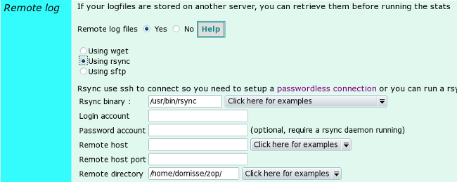
Time to use a javascript tool to display countries stats. I had to
choose between jvectormap and jqvmap. I have selected
jvectormap as it
was the only one with markers. Sadly, there is only a very small
number of maps available (jqvmap includes continents maps but they
cannot be used with jvectormap :(
Also latest jvectormap version was more than one year's ago, maybe a
dead project :( Nethertheless, it's a very good package :)
Here is a preview (darker color and bigger circles means higher values)
|
Europe map with city stats enabled
|
Map of germany with regions
|
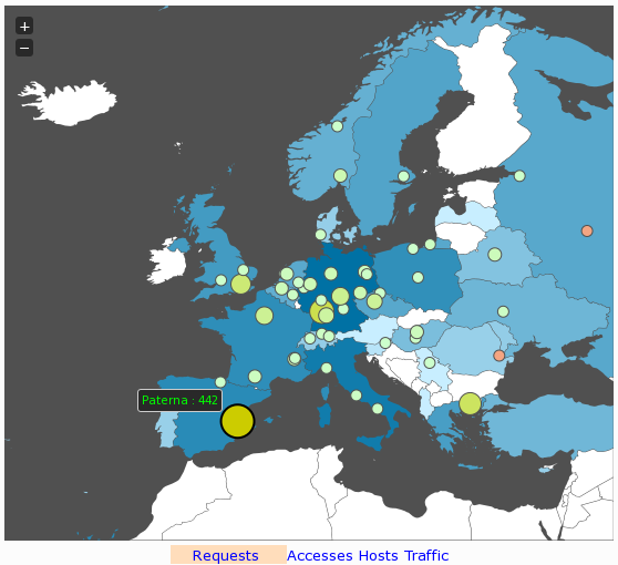
|

|
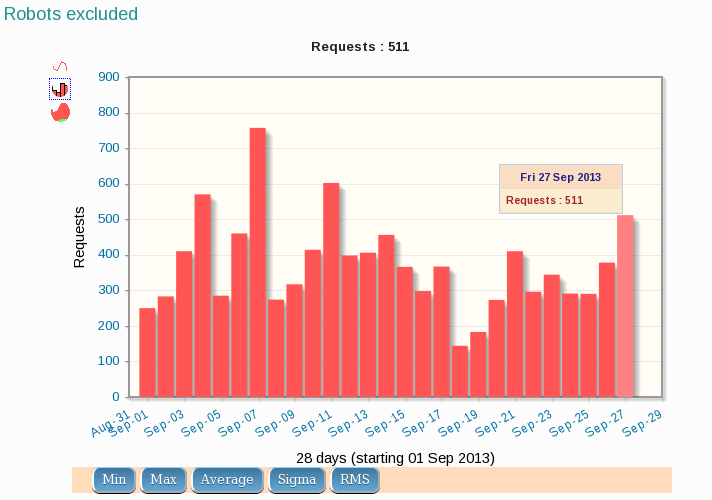
Remaining jobs :
- Build continent maps (you need to use convert.py 1.1.1 as the latest
version 1.2.2 doesn't work)
- More country maps
- Region stats
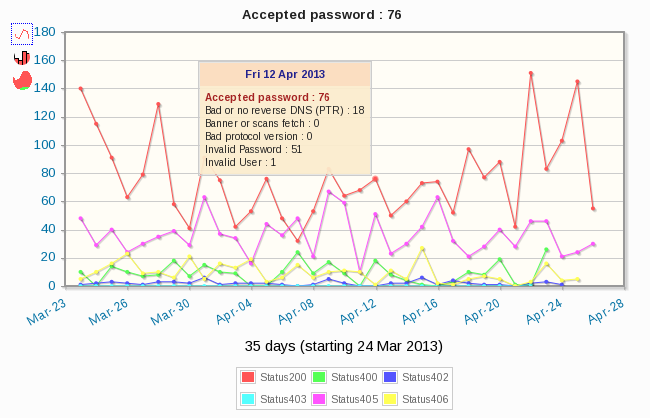
Many maps are available within this tool :
jvectormap-maps-builder.
But nothing's perfect....some maps have problems (missing regions,
wrong name, too large ...) and the remaining task is to match region's name with the
ones from GeoIP data ! For instance, GeoIP gives hundred of counties
for United-kingdom where jvectormap map uses only eight ! On the other
side, GeoIP have only 5 counties for Finland but the map display many more.
Once completed, I will release the next stable release 3.19 !